CoCoRaHS Precipitation Map
ParsonsWeather.com is proud to be a contributing member of CoCoRaHS since 01-Nov-2007. Our manual gauge measurements are made at 8:00am daily and reported to the CoCoRaHS website. The current reports for Decatur County are shown on the map below.
Since the automated rain reports on this site are from midnight and the CoCoRaHS gauge is from 8:00am, the daily rain reports may differ due to the differing times for measurement resets (automatic gauge: midnight, CoCoRaHS gauge: 8:00am).
Parsons:
CoCoRaHS is an acronym for the Community Collaborative Rain, Hail and Snow Network. CoCoRaHS is a unique, non-profit, community-based network of volunteers of all ages and backgrounds working together to measure and map precipitation (rain, hail and snow). By using low-cost measurement tools, stressing training and education, and utilizing an interactive Web-site, their aim is to provide the highest quality data for natural resource, education and research applications. The CoCoRaHS network originated with the Colorado Climate Center at Colorado State University in 1998 thanks in part to the Fort Collins flood a year prior. In the years since, CoCoRaHS now includes thousands of volunteers nationwide.
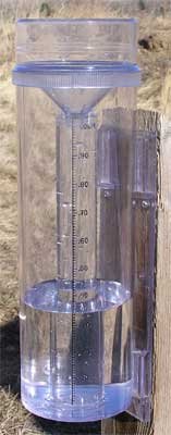
The CoCoRaHS precipitation measurements are done using a 4-inch manual rain gauge.
 |
 |


